Send us a message!

Schedule a Consultation

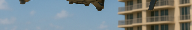
Comprehensive Aerial Imaging & Videography

High-resolution stills, 4K video, thermal imagery, and orthomosaic mapping - delivered in GIS-compatible formats.

  • Supports inspection reports, engineering assessments, and legal documentation.
  • Captures wide-area damage or structural conditions in a single flight.
  • Output includes orthomosaic files, CAD overlays, and raw media as needed.

3-D & Topographic Mapping

Engineering-grade 3D terrain and structure mapping to support infrastructure and documentation efforts.

  • Generates precise elevation models and structural contours.

Rapid Emergency & Disaster Deployment

Nationwide drone response for swift assessments after storms, natural disasters, and high-risk events.

  • Fast mobilization to disaster zones for immediate visual documentation.
  • Helps expedite claim triage, adjuster deployment, and emergency planning.
  • Aerial perspective allows access to unsafe or restricted areas without delay.

Infrared (IR) and Thermal Drone Imaging

Advanced thermal scanning to detect heat anomalies, moisture, and insulation issues—even during FAA-authorized nighttime operations.

  • Detects hidden issues not visible in standard photography.
  • Supports moisture mapping, roof diagnostics, and energy audits.
  • Nighttime inspections available with FAA-compliant operations.

Specialized Aerial Inspections

Safe, detailed inspections of hard-to-access areas including roofs, towers, and industrial sites.

  • Avoids the need for lifts, scaffolding, or rope access.
  • Captures high-res images and thermal scans to identify damage or wear.
  • Supports inspections for claims, maintenance, or compliance documentation.

Parrot Key Drone Division

Parrot Key Drone Division | Aerial Inspections, LiDAR, and Thermal Scanning Services

The Parrot Key Drone Division delivers nationwide drone inspection services for insurance carriers, TPA firms, engineers, attorneys, contractors, and mitigation professionals. We specialize in LiDAR surveying, thermal imaging, volumetric analysis, and high-resolution aerial photography for storm damage assessments, structural inspections, and site planning. Our FAA-certified drone team provides fast, accurate, and defensible data in GIS-compatible formats. From emergency disaster response to engineering-grade 3D mapping, Parrot Key is your trusted aerial intelligence partner. Contact us today for aerial support this storm season.

© 2025 Parrot Key, Powered by Shopify

    • American Express
    • Apple Pay
    • Diners Club
    • Discover
    • Google Pay
    • Mastercard
    • PayPal
    • Shop Pay
    • Visa

    Login

    Forgot your password?

    Don't have an account yet?
    Create account